5.1.6.1 Scenario phase 1: Characterising the North Devon Case Study area

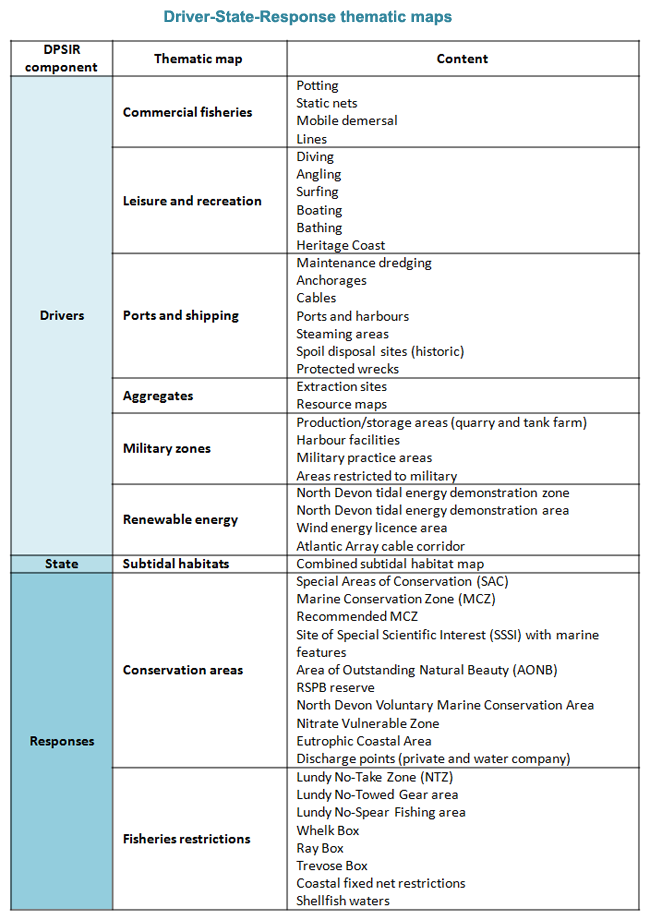
A Driver-Pressure-State-Impact-Response (DPSIR) analysis was carried out to characterise the North Devon case study site, focus data collection and inform the ecosystem services assessment, scenario development with stakeholders and socio-ecological modelling work.
- Drivers were considered to be proximal (i.e. activities) rather than underlying (social, political, economic or climatic).
- Pressures associated with activities were identified via literature review and established frameworks e.g. JNCC activities/pressures matrix, MarLIN.
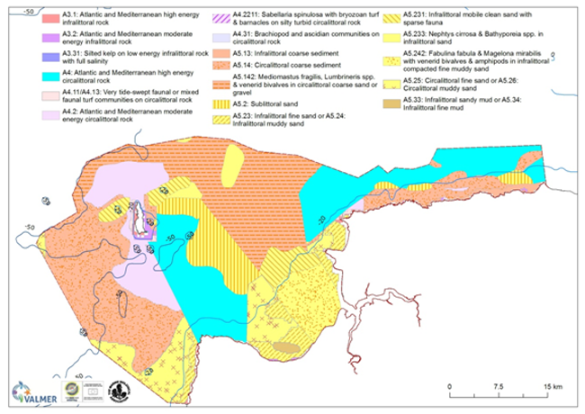
- State corresponds to the subtidal sediment habitats and their ecological communities. Considerable species and habitats records data on the subtidal sediment habitats were collated in a geospatial database in order to generate a composite habitat map of the area, together with a confidence map of the underlying data. This not only informed the ecosystem services assessment, but also provided the foundation layer for the socio-ecological model.
- Impact is emergent from this study as the human welfare impacts of pressures on the subtidal sediment habitats.
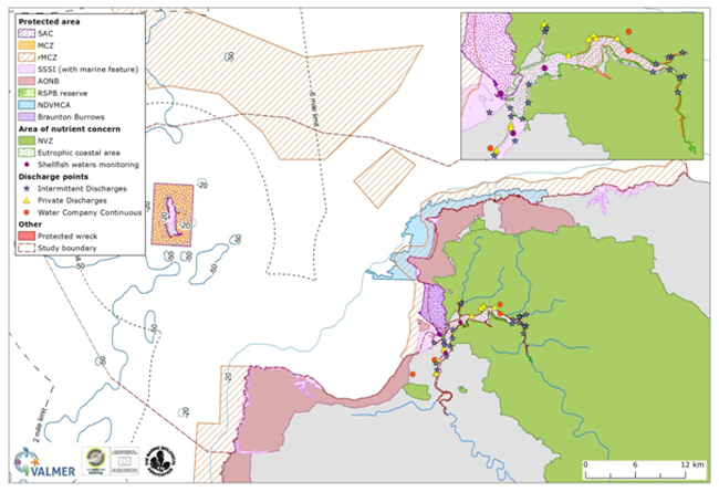
- Responses comprised both the existing arrangement of management interventions e.g. fisheries restrictions, MPAs, plus possible future ones such as the designation of Marine Conservation Zones.
Maps of the ‘current situation’ were produced to show the spatial extent and where relevant, intensity of indicators for each of the Driver-State-Response elements.
These were used in the ecosystem services assessment and comprised the comparator for the socio-ecological model outputs for changes in service flows under divergent management scenarios.
The maps were presented to the first stakeholder group meeting and were supplemented with further data and expert knowledge and validated (following table).
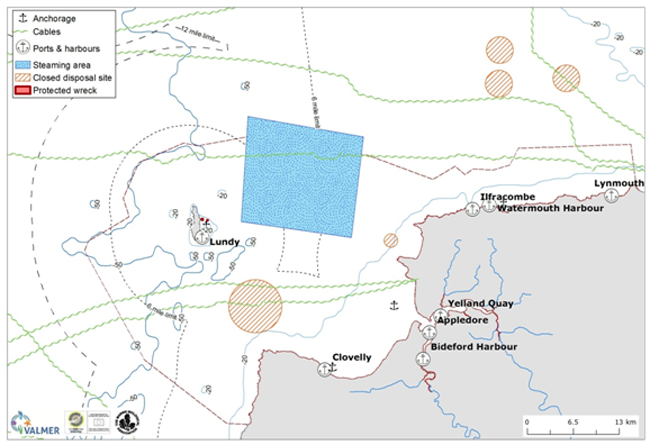
An example thematic map for a Driver (ports and shipping) and management Response (conservation areas) and the ecological State of the seabed (combined habitats map) is given in the following figures.

 Figure: Example of Driver thematic map - ports and shipping (various sources).
 Figure: Ecological State thematic map: combined subtidal benthic habitats map (sources: RWE surveys, UKSeaMap, Warwick & Davis Bristol Channel sediments, BIOMOR4 (Outer Bristol Channel Survey), Lundy Habitat mapping surveys, Barnstaple Bay grab sampling, MNCR Inlets in the Bristol Channel).
 Figure: Example management Response thematic map – conservation areas (various sources).

