5.5.1 Parc Naturel Marin d'Iroise: Site description


Physical environment
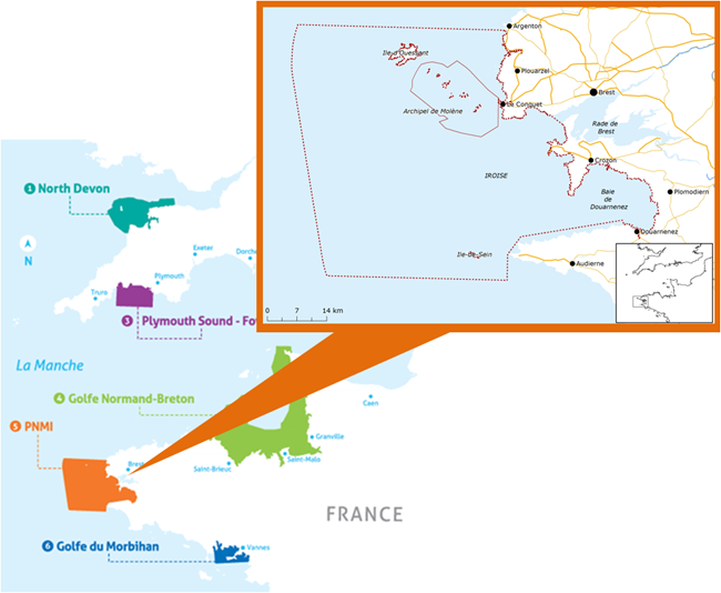
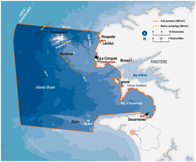
The Parc Naturel Marin d'Iroise was created in 2007 off the coast of Finistère between the islands of Ushant, Molène and Sein and the coasts of Crozon headland and Douarnenez bay. The Molène’s archipelago has the most diverse European algae Laminaria fields and the most extensive ones in France.
 Figure: Perimeter of the Parc Naturel Marin d'Iroise (Agence des aires marines protégées, SHOM)
It is a shallow area of nearly 400 km² with rocky and sandy substrates, dotted by many small islands. This area is characterized by a huge tidal range and the proximity of the thermic Ushant front that mixes the coastal waters. As regards the latitude, the sea temperature remains quite low. The mixing prevents the seasonal thermocline settlement and the warming of the surface layer. These physical features enable the development of cold water affinity kelp species. Thus, the Parc Naturel Marin d'Iroise is the southern distribution limit of many species area and Laminaria digitata is considered as a sentinel of these species.
This area is particularly important due to the outstanding natural ecosystems containing dozens of species of algae, marine mammals and birds. In addition to its Marine Natural Park status, this region of the Iroise sea is a Marine Protected Area under the Oslo-Paris convention (OSPAR) and a large part of its perimeter is listed under the European Habitats and Birds directives (Natura 2000 network) and has been recognized as a UNESCO human biosphere reserve since 1989.


