5.1.6.3 Scenario phase 3: Establishing the key variables and developing pressure maps

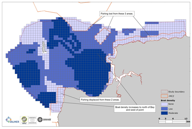
Pressure maps were developed using the activity maps generated by the DPSIR analysis. Fishing activity was the most important due to its large spatial footprint across the case study area. Levels of fishing activity (given in Finding Sanctuary’s Fishermap [des Clers et al., 2008] as boat density per month) were rescaled to align with a known classification of intensities of activities and ecological impacts on benthic habitats [Hall et al. 2008] and comprised the abrasion pressure layer.
Changes in key pressures were identified and quantified from the scenario narratives developed by the stakeholder group in collaboration with the project team.
These were represented in terms of changes in intensity and spatial extent relative to the current situation (known activities and their pressures).
The effect of these pressures on the subtidal sediment habitats and their capacity to deliver the selected ecosystem services was established from a review of the literature.
The results of this work comprised detailed scenario descriptions and pressure layers for conditioning the socio-ecological model.

Figure: Example of a pressure layer used to condition the SES model: intensity of demersal fishing activity as a proxy for seabed abrasion under the rMCZ designation scenario. Loss of pressure and increases due to fisheries displacement are indicated.

